Visualizing Space Usage and Movement Patterns in Kampung Admiralty
Interactive Data Visualisation
Team: Anjanaa Devi Srikanth, Tay Jing Zhi
Kampung Admiralty
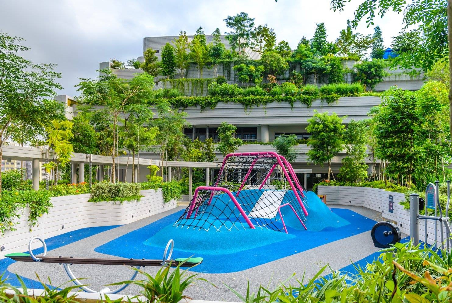
Level 6 Playground
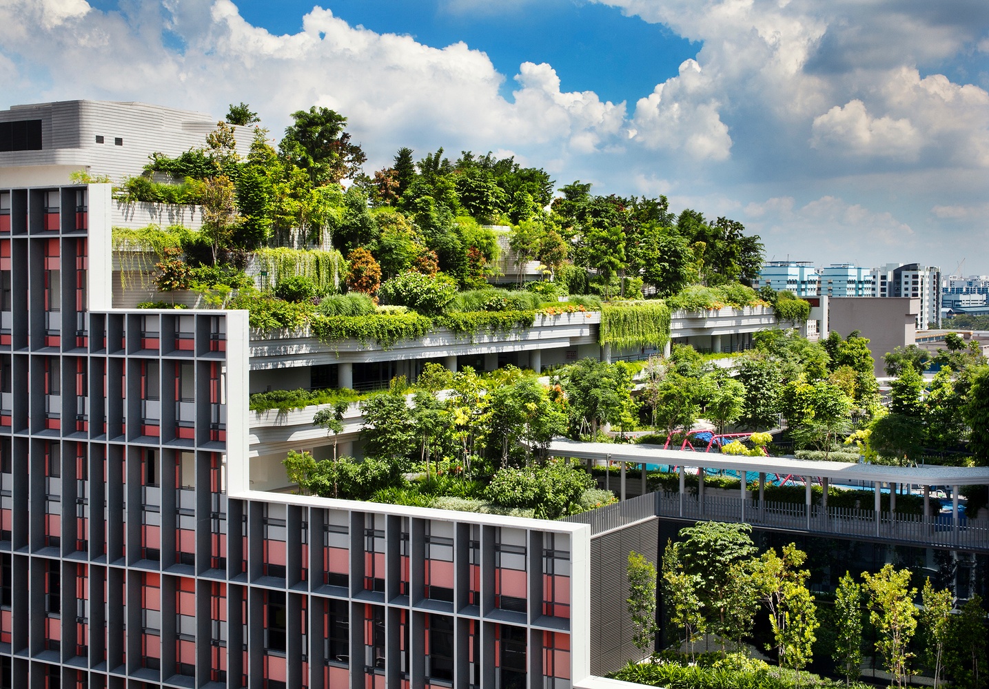
Levels 8, 9 Community Gardens at Kampung Admiralty
Level 1 Public Plaza
Level 2 Food Court overlooking the Public Plaza
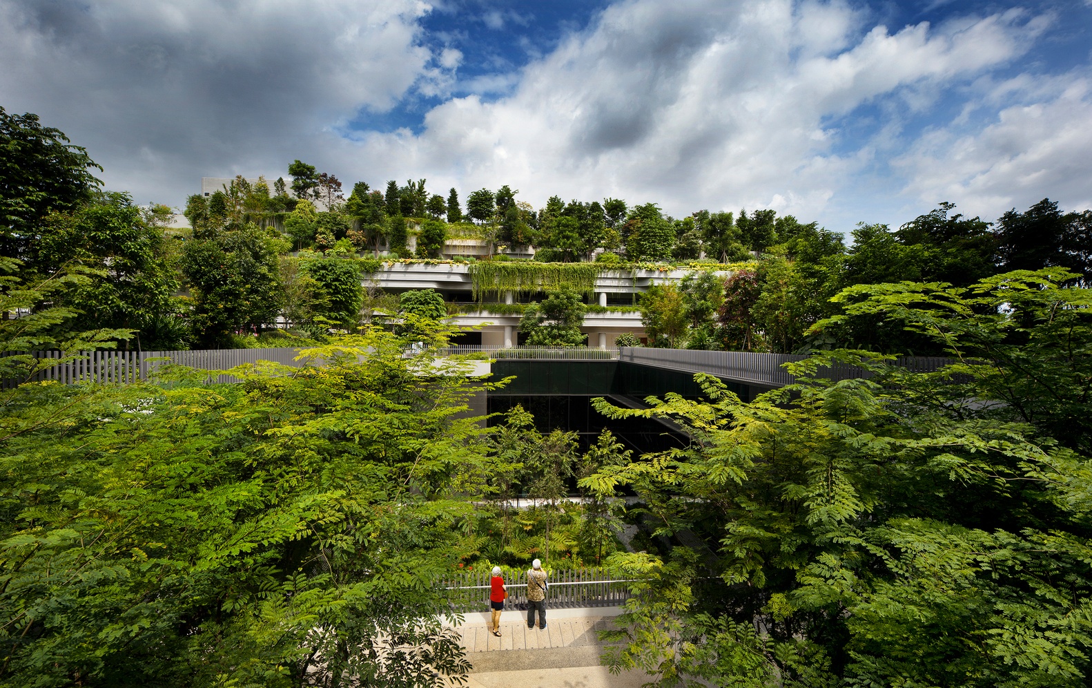
Vertical Public and Green Levels at Kampung Admiralty
Level 4 Medical Centre
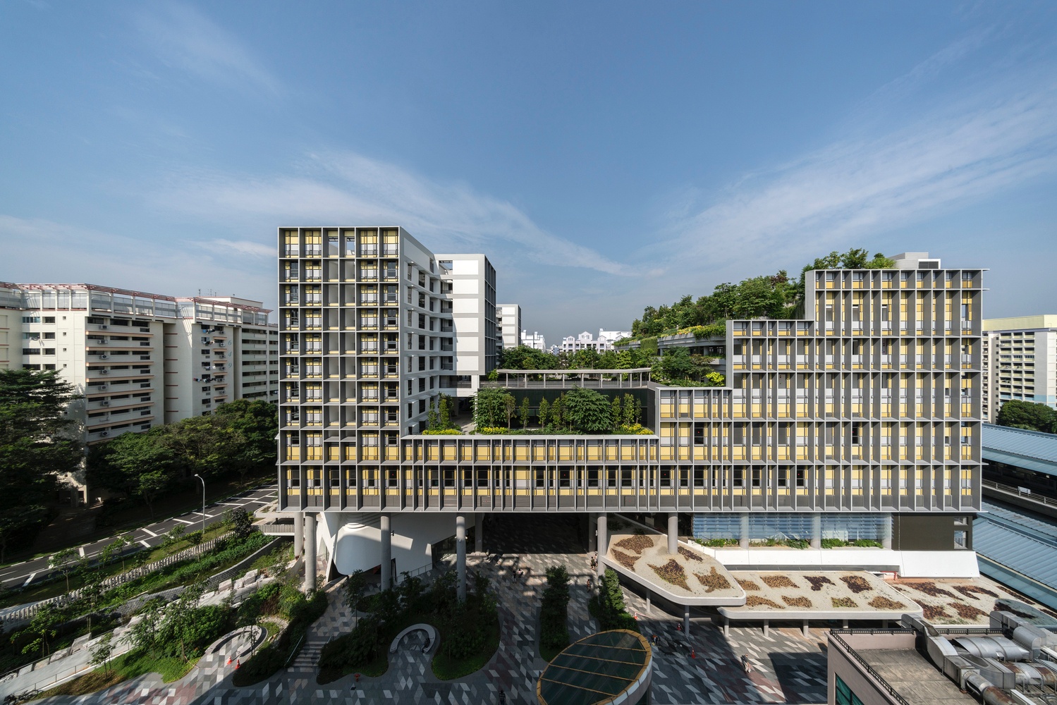
Aerial View of Kampung Admiralty
Integrated vertical developments are increasingly studied and planned in high-density cities. To investigate the success of vertical integration, we analyze tracked user activity in one development: Kampung Admiralty.
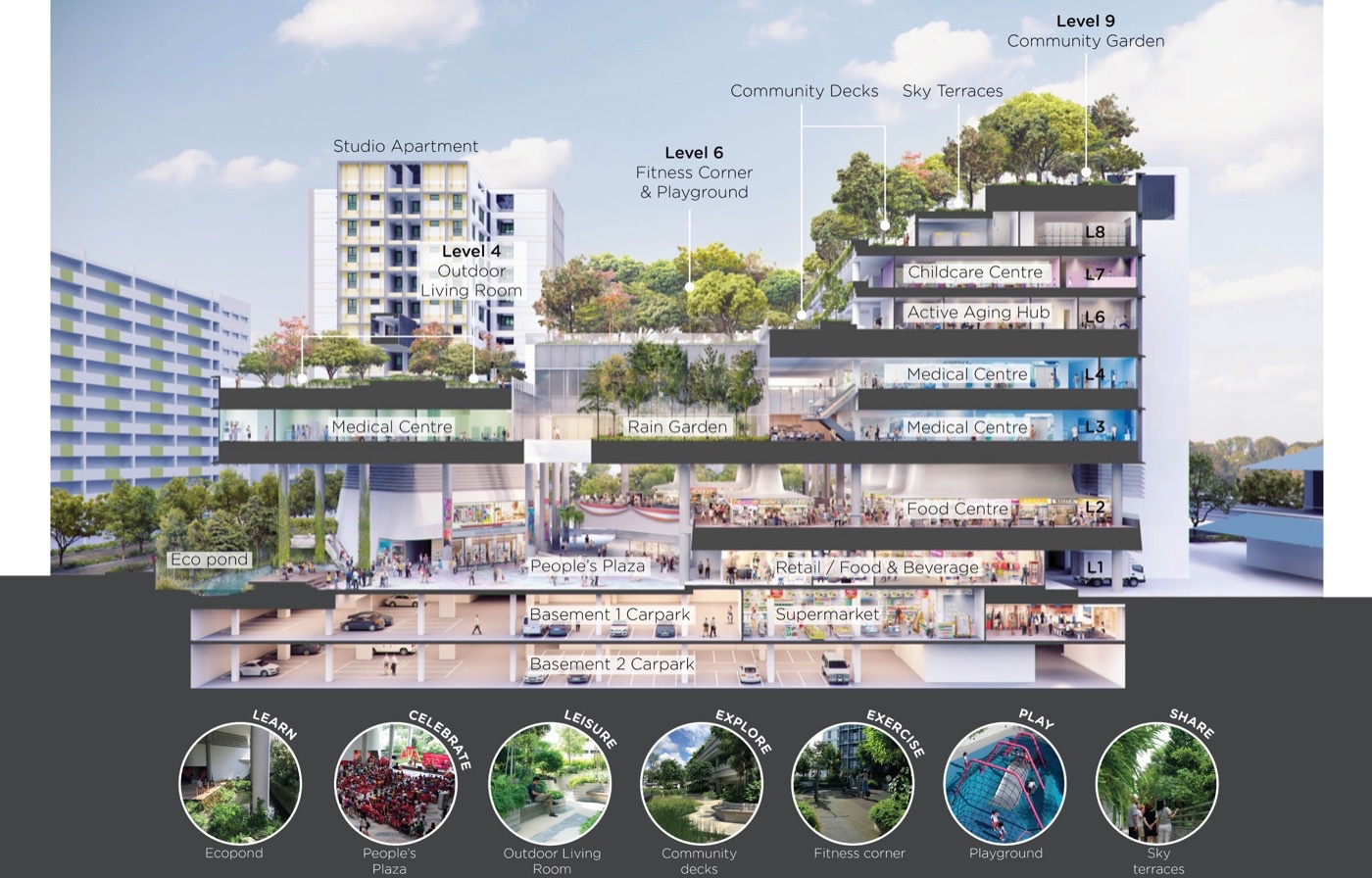
Kampung Admiralty is the first development in Singapore to fully integrate housing for the elderly in a "vertical village." Located next to Admiralty MRT station, the multi-award-winning development offers 104 senior apartments with a host of facilities including a medical center, pharmacy, retail, restaurants, a hawker center (an open-air pavilion with food stalls), and a public park and plaza.
The Advanced Architecture Lab team in SUTD conducted an experiment in February 2021 to map people movement patterns and the usage of spaces in the vertical development. Using Bluetooth sensors to capture movement via a smartphone-based app, the experiment took place with 70 paticipants who were categorised as residents, employees and visitors. To better understand the usage of spaces in the vertical layout, we visualize the data of user movement.
How long does each user spend in public spaces in Kampung Admiralty?
What are the trends of time spent in Kampung Admiralty over weekdays and weekends (and special occasions)?
Which public spaces in Kampung Admiralty are used the most?
Which spaces are the main attractors on each level?
How are different user groups using the space?
Which circulation path is most travelled?
What are the sequence of spaces visited for each trip?